How can flood data be more useful?
In emergency flood disasters, what information is needed from scientists? How should data be presented and within what timeframe? This research project aims to gain a deeper understanding of organisations’ flood data needs, in order to produce more useable science.
Flooding is a natural hazard that affects millions of people throughout the world every year. Fatalities from flooding occur disproportionally in developing countries, where difficulties in relief efforts are compounded by lack of information about flood and settlement patterns.
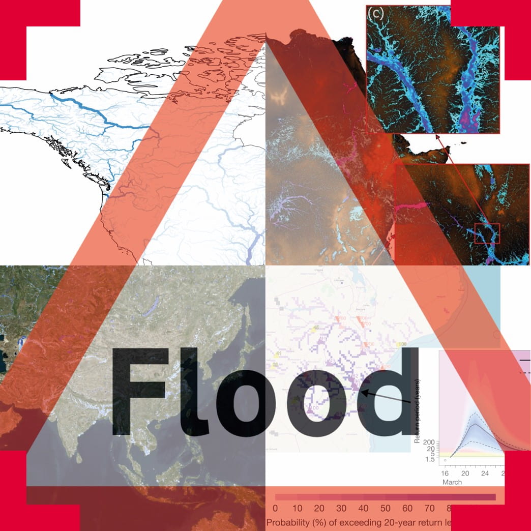
Flood data produced by physical scientists is used by a variety of organisations to coordinate flood responses in the field. Developing appropriate forms of data presentation, including maps, is a challenge because users of this data are diverse, ranging from global NGOs to under resourced grassroots NGOs. These organisations have diverse cultural, bureaucratic and technological practices. Preferred methods for visually presenting data and linguistic questions around risk are also likely to vary.
What did the project involve?
This interdisciplinary project will draw on the experience and expertise of flood data users, social scientists, cartographers and linguists. The project sought to engage with stakeholders from organisations in the UK and globally who work in flood relief. Through the insights gained they developed sample maps and gained further insights into useable formats of flood data. They used discussions to inform and test flood data design principles. At the end of this process, they published their recommendations for future data design that will improve emergency responses to disaster relief at a global scale.
Who are the team and what do they bring?
- Laurence Hawker (Geographical Sciences, University of Bristol) has expertise in Digital Terrain Models, hydrodynamic models, population datasets and flood risk estimates. My research spans spatial scales, with global applications and more specific examples such as work in Mozambique and Vietnam.
- Beth Tellman (The Earth Institute, Columbia University, Cloud to Street) is a human-environmental geographer, seeking to address the causes and consequences of global environmental change for vulnerable populations, with a focus on flood risk and land use change.
- Andrea Ficchi (University of Reading) is a hydrologist specialising in flood forecasting and evaluation of global hydro-meteorological predictions. He is contributing to the development and evaluation of a global flood prediction system to support humanitarian early actions across sub-Saharan Africa.
- Elizabeth Haines (History, National Archives) is a historian with an interest in exploring the history of global processes through co-produced, creative research. Her PhD was a collaborative doctoral award in Historical Geography from Royal Holloway, University of London and the Science Museum, exploring the role of mapping in colonial governance practices in Northern Rhodesia [Zambia].
- Shaun Harrigan (European Centre for Medium-Range Weather Forecast, ECMWF) works on operational hydrological forecasting of both floods and low flows from short and medium range to subseasonal-to-seasonal lead times at continental and global scales. He specialises in forecast evaluation and has a particular interest in understanding where and when forecast products are useful to different end users.
- Sara de Wit (Science, Innovation and Society, University of Oxford) works at the intersection of development theories, environmental anthropology and postcolonial studies.
- Emma Mumford (MapAction) regularly interacts with flood data users by providing emergency response bulletins.
- Emmalina Glinskis (Cloud to Street) works with users to co-produce flood products, mostly in the developing World.
- Natalie Zelenka (Jean Golding Institute) at the time of this project was a Data Scientist in the Jean Golding Institute, University of Bristol. She works in applied data science, data science ethics, and computational biology.and has an interest in survey design and map integration.
- Anne-Laure Donskoy (Sociology, Politics and International Studies) is an intern conducting interviews of flood users in NGO’s, humanitarian organisations and government agencies.
- Leanne Archer (Geographical Sciences) is an intern investigating best cartographic practices to present flood data.
What were the results?
You can view a demo of the map here, or delve into the corresponding code used here. This map was being continually updated as the project progressed white being open to view from the public, so people could come back to see it evolve.
In the blog post “How can flood data be more useful? Initial Interviews” the researchers provide an update on the progress of the project and highlight key contributions.
You can view the Participant Information Sheet for more information on the surveys the team conducted to inform their research.